

UAVs for HABs Monitoring
Eutrophication and harmful algal blooms (HABs) pose a pervasive threat to the ecological health and community enjoyment of global freshwater and coastal ecosystems, impacting water quality, marine life and human health. Climate change has shifted hydrologic and meteorologic patterns, causing intensified nutrient loading from urban and agricultural pollution. Consequently, preventing the eutrophication of water bodies has become a high priority project for many municipalities that rely on water bodies for drinking water, recreation, fishing and tourism. As we strive to understand, monitor and mitigate the effects of eutrophication and HABs, the integration of cutting-edge technology has become indispensable, offering critical insights into complex ecosystems.
Unmanned aerial vehicles (UAVs, commonly known as drones) have emerged as pivotal tools in remote environmental sensing and habitat monitoring, with increasing applications for understanding and managing HABs. UAVs are autonomous or remotely piloted aircraft that can be equipped with a diverse array of sensors and imaging devices to enable them to collect a wealth of data from their surroundings. In environmental monitoring, UAVs capture real-time, high-resolution imagery and georeferenced data across diverse and remote or inaccessible habitats. UAVs play a pivotal role in tasks such as vegetation analysis, land cover mapping and topographic surveys, and—most importantly for HABs—can also be used to remotely detect and quantify algal concentrations in water bodies. UAVs provide safe, cost-effective and rapid means of surveying environmental conditions, contributing crucial information for effective natural resource management.
UAVs vs. Traditional HABs Monitoring
UAVs can be quickly deployed on-demand to monitor large and/or inaccessible areas efficiently while reducing the environmental and health consequences of traversing through protected, fragile, or toxic ecosystems. UAVs with sensors for HABs monitoring offer numerous advantages over traditional, aerial HABs monitoring methods (e.g., manned aircraft or satellite sensing). UAV-based HABs monitoring can be more flexible than manned aircraft or satellite sensing because users can select/alter the flight path and adjust spatial, spectral and temporal resolutions based on site-specific needs. Additionally, because of the lower flight elevation, image acquisition is not inhibited by cloud cover, which can be a major limitation to manned aircraft or satellite imagery analysis. UAVs can also typically achieve higher spatial and temporal resolution than traditional satellite imagery. Further, UAVs, used in conjunction with routine water quality measurements or in-situ remote sensing instruments, ensures a multi-dimensional perspective on water body dynamics, facilitating more accurate analyses and informed decision-making for water resource management and environmental conservation.
Sensor Technologies for HABs
Various sensor types can be deployed on UAVs to glean insights into the occurrences and patterns of HABs in aquatic environments. The selection of sensors depends on the specific objectives and requirements of the monitoring mission. However, some commonly available sensors for this purpose are highlighted below.
Conventional Photogrammetry

Photogrammetric Aerial Mapping of Stream Corridor and Wetland Area Restoration.
Conventional photogrammetry refers to the traditional method of obtaining measurements and deriving information from photographs. Via image analysis, standard photographs offer a preliminary understanding of HABs drivers or indicators, such as changes in water color, topographical and hydrological features, and temporal dynamics. Recent developments in machine learning algorithms for automated image analysis have further enabled the extraction of meaningful patterns and insights from photographs. While conventional photogrammetry does not provide the same detail and accuracy as some other advanced, dedicated sensors, the combination of traditional photogrammetric techniques with modern analysis tools can provide a preliminary screening tool for HABs and support effective environmental management strategies.

Thermal image revealing a pipe location.
Thermal Imaging
Thermal imaging cameras operate by capturing the infrared radiation emitted by objects and surfaces, such as water. Infrared radiation is directly influenced by temperature. As algal blooms undergo metabolic processes, they can generate distinctive temperature differentials compared to the surrounding water. Thermal imaging cameras can highlight these variations, making it possible to pinpoint specific locations within a water body where potential HABs hotspots exist. This thermal perspective allows for enhanced monitoring, especially in larger water bodies where traditional sampling methods may be logistically challenging.
Best Practices
Implementing UAVs for HABs monitoring requires careful planning and adherence to best practices. There are several important factors that users should consider when planning a UAV flight for HABs detection.
Equipment Selection
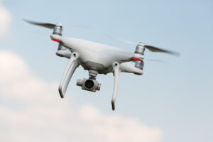
Commercial rotorcraft drone system equipped with a camera.
Choosing the appropriate equipment based on the specific needs of the HABs monitoring program is a crucial first step in planning for a UAV flight. There are several UAV platforms currently in use for HABs monitoring, with the two most common being fixed-winged UAVs and rotorcraft UAVs. Fixed-wing UAVs are best for HABs that affect larger spatial extents due to aerodynamic factors that extend their flight time. Rotorcraft UAVs are advantageous for higher resolution collection due to their maneuverability.
Once an appropriate UAV platform has been selected, project-specific sensors should be determined. Sensor capabilities govern which type of information can be collected and the precision of the data. The UAV platform selected may limit the number or types of sensors that can be flown simultaneously, and this is important when considering the indicators that will be used to extract HABs information.
Flight Logistics and Regulatory Compliance
Flight logistics are a very important planning step. Development of a detailed flight plan that systematically covers the target area is necessary to optimize data collection and ensure full coverage of the monitoring area. Adverse weather, including strong winds, rain, or low visibility, can impact UAV operations and data quality or produce blur in UAV images, so it is also necessary to plan for and adapt to these factors when flying. Additionally, compliance with airspace regulations is crucial to ensure safe and legal UAV flights. Teams should be familiar with local aviation regulations and must obtain the necessary permits for UAV operations. TRC focuses on its adherence to high safety standards at all levels of its teams and in all aspects of its procedures.
Data Calibration and Validation
There are a variety of radiometric or ground-based calibration techniques used to normalize data across multiple flight days. Factors such as differences in sun angle, sun glint and shadows can produce variations in certain parameters. Sensors should be calibrated regularly to maintain accuracy and reliability. In addition, UAV-derived data should be validated by comparing it with ground-truth measurements or data from other monitoring methods to ensure accuracy. Common validation techniques include in-situ water quality sampling of chlorophyll a, turbidity, total suspended matter and surface water temperature; field sampling of algal cover and phytoplankton spectra; and using microscopy to identify specific algal species.
Data Processing and Analysis
A robust data processing workflow should be established to efficiently handle and analyze the large datasets to this particular field of study. Software tools are available for image processing, data analysis and visualization, but few software options encompass this entire workflow. Therefore, a combination of software packages may be required to fully process and analyze the dataset.

TRC’s UAV equipped with a RESEPI LiDAR Sensor.
TRC Can Help!
TRC’s UAV fleet has supported wide range of environmental, infrastructure and survey projects, including environmental inspections, emergency inspection and documentation, infrastructure inspections, topographic survey, mapping, videography and thermal imagery. Other common field activities that could be streamlined through UAV implementation include piping and facility aerial scanning, advanced landslide and slip monitoring, habitat classification, and advanced environmental studies and classifications. We have multiple Federal Aviation Administration (FAA)-Certified Remote Small Unmanned Aerial System Pilots located across the United States who have extensive experience safely operating UAVs and performing UAV image processing, data analysis and visualization.
For more information regarding TRC’s UAVs and HABs monitoring capabilities, please contact one of our experts below.

Charles Jurden
Charles Jurden leads TRC Survey’s Drone operations. He is a Surveyor in Training (SIT) and with the Pittsburgh, Pennsylvania office. He started with TRC in 2017, where he helped implement the TRC Survey Drone program, and create current workflow. He completed his Master of Science in Geographic Information Science and Technology in 2018 with a focus on Remote Sensing using RS and drone technology for mapping and monitoring at the University of Southern California. Contact Charles at CJurden@trccompanies.com..

Amelia Jones
Amelia Jones leads TRC’s internal Center of Research and Expertise (CORE) Emerging Contaminants Harmful Algal Blooms (HABs) sub-team and has given several presentations and workshops on HABs. She is a Senior Engineer in the San Francisco, California office. She started her environmental engineering career at TRC in 2018 as a Staff Engineer in the Concord, California office. Prior to that, Amelia received a Master of Science in Civil Engineering from University of California, Davis, applying Water Resources Engineering to explore ecosystem dynamics at Lake Tahoe, California/Nevada.
As the HABs sub-team leader, Amelia is focused on developing TRC’s services for HABs management on top of her project work. Her main responsibilities include remedial design and construction; environmental compliance program development and implementation; digital field data collection; environmental database management; and project management. Contact Amelia at ATJones@trccompanies.com.
